Climate change represents one of the most significant challenges of our time, characterized by rising global temperatures, shifting precipitation patterns, and increasing frequency of extreme weather events. Scientists employ a plethora of methodologies to measure and analyze climate change, utilizing both terrestrial and satellite-based techniques. These methodologies yield invaluable data that inform policymakers, researchers, and the public at large. Have you ever wondered how those seemingly innocuous numbers on weather reports translate into broader conclusions about climate health? The methods scientists use are complex yet fascinating, encompassing a variety of disciplines and technologies.
One key area of study is atmospheric measurements, which depend largely on advanced satellite systems. Satellites orbiting Earth, like NASA’s Atmospheric Infrared Sounder (AIRS), provide critical data on temperature, moisture levels, and greenhouse gas concentrations. These satellites use infrared sensors to measure radiation emitted by the atmosphere, allowing scientists to grasp the intricate dynamics of climate change. For instance, combined data from the Atmospheric Infrared Sounder and other satellite systems enable the monitoring of carbon dioxide levels from the surface upward, giving us a comprehensive snapshot of global emissions.
But how do you capture something as ephemeral as carbon dioxide? The answer lies in a network of ground-based observations. Stations globally, such as the Mauna Loa Observatory in Hawaii, meticulously track atmospheric carbon dioxide levels. This data is vital; it allows scientists to establish a baseline for carbon levels and monitor changes over time. Interestingly, the Mauna Loa Observatory has been instrumental in the collection of carbon dioxide data since the late 1950s, revealing a troubling upward trend that correlates strongly with industrial activity.
In addition to atmospheric measurements, researchers also delve into oceanic studies, understanding that the oceans play a pivotal role in regulating the Earth’s climate. Ocean buoys and ships equipped with sophisticated instruments measure sea surface temperatures, salinity, and ocean currents. The Argo float system, for example, employs autonomous buoys that drift with ocean currents while measuring temperature and pressure at various depths. This robust dataset helps scientists monitor heat absorption in oceans, which directly influences global weather patterns and sea-level rise.
Additionally, scientists analyze ice cores and tree rings to gain insights into historical climate patterns. Ice cores extracted from glaciers contain trapped air bubbles that provide a historical record of atmospheric composition over millennia. Each layer of ice represents a year of snowfall, trapping greenhouse gases and particulate matter. These cores act as time capsules, revealing past climate conditions. Similarly, tree rings can indicate wet and dry years; the width of each ring corresponds to the growth conditions during that year. By studying these natural archives, researchers can establish long-term climate trends and understand how ecosystems have responded to climatic shifts.
Notably, climate models serve as another cornerstone of climate change research. These complex computer simulations utilize extensive datasets, including atmospheric and oceanic measurements, to project future climate scenarios. Models such as the Community Earth System Model (CESM) simulate interactions between the atmosphere, oceans, land surface, and ice. The iterative simulations generate projections of future climate conditions based on various greenhouse gas emissions trajectories. While these models are indispensable tools, they also evoke a playful question: How accurately can we predict the unpredictable nature of our climate system? Given the complexity of climate interactions, this is a formidable scientific challenge.
One fascinating aspect of climate measurement is the incorporation of citizen science. Recently, initiatives have encouraged ordinary people to contribute to climate monitoring through apps and online platforms. For example, Global Forest Watch enables individuals to report local deforestation or changes in land cover, enhancing the dataset available to scientists analyzing global forest loss and carbon emissions. This democratization of data collection poses the challenge of ensuring data reliability, yet it cultivates a shared responsibility for combating climate change.
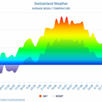
The dissemination of climate data contributes significantly to public awareness and action. Organizations often collaborate to create accessible platforms showcasing climate metrics. These websites and apps present data visually through graphs and maps, making it easier for individuals to understand the implications of climate change. However, could simplification of such complex data lead to misinterpretation? It is a delicate balance, and ongoing public education is essential to fostering informed discourse surrounding climate science.
In conclusion, scientists employ an impressive arsenal of techniques to gauge climate change—spanning airborne and ground-based observations, historical analysis, modeling, and citizen engagement. Each approach contributes a unique piece to the intricate puzzle of our planet’s changing climate. As our understanding grows, we remain suspended in a state of urgency, urging immediate action in the face of escalating climate threats. As we reflect on how detailed this scientific endeavor is, it beckons a collective challenge: how can we encourage active engagement to foster a climate-literate society? The time to act is now, and knowledge is an invaluable first step toward addressing the existential threat of climate change.